Lahabali kɔligu:Pollution in Maracaibo lake.jpg
Jɔhiyuli maa galisim:800 × 429 anfooni bihi bihi. Din pahi resolutions: 320 × 171 anfooni bihi bihi | 640 × 343 anfooni bihi bihi | 1,024 × 549 anfooni bihi bihi | 1,280 × 686 anfooni bihi bihi | 2,560 × 1,372 anfooni bihi bihi | 4,588 × 2,458 anfooni bihi bihi.
Faal maa maŋmaŋa (4,588 × 2,458 pixels, file size: 8.98 MB, MIME type: image/jpeg)
Lahabali jia
| Buɣisibu |
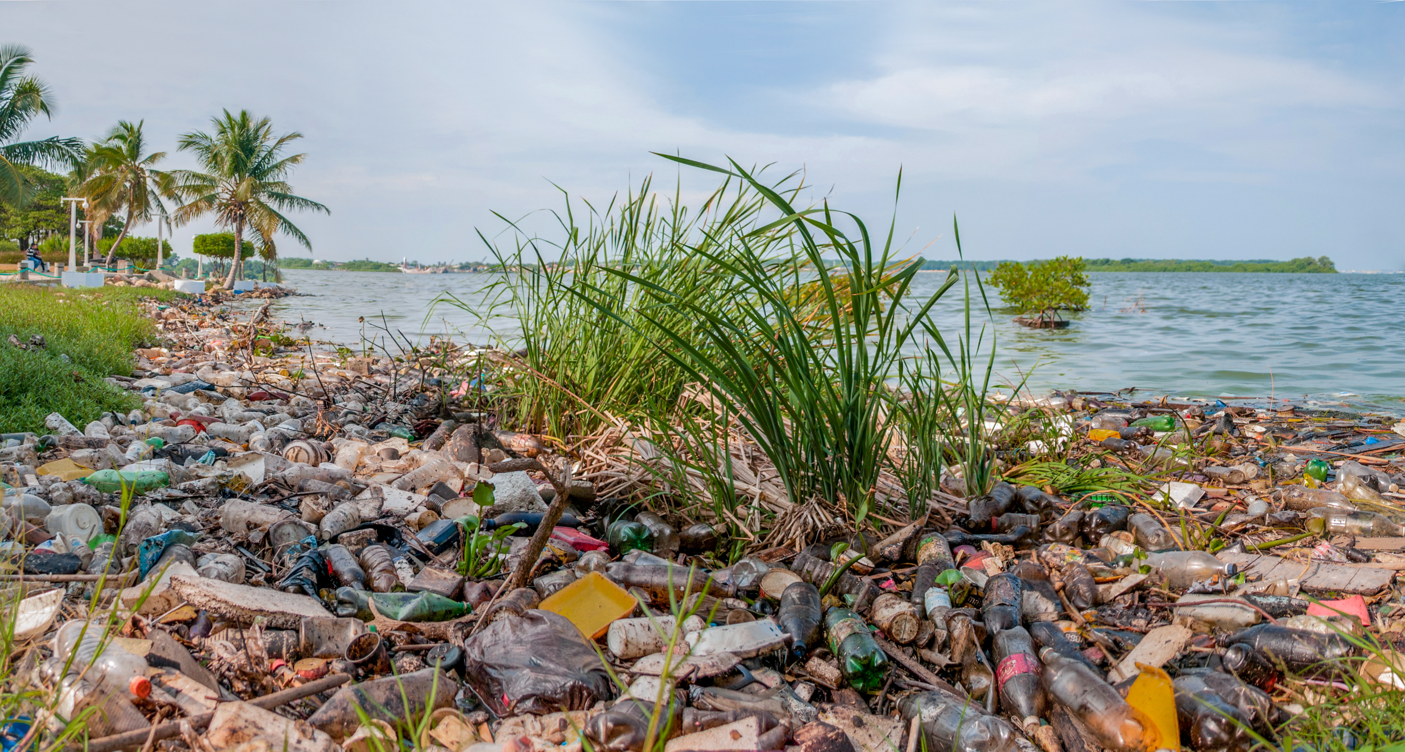
Español: El Lago de Maracaibo se encuentra ubicado en el Estado Zulia, Venezuela, es el lago mas grande de Sudamerica con un area de 13.820 km²[1], es común observar este tipo de contaminación a lo largo de todas sus costas contaminadas con lemmna sp, derrames de petroleo y desechos humanos son los principales contaminantes. Las actividades agrícolas, pecuarias, mineras e industriales, sin control, desarrolladas en la cuenca del Lago de Maracaibo, han originando un proceso acelerado de eutrofización en el mismo.[2]
English: Maracaibo Lake situated in Estado Zulia Venezuela is the biggest lake of South America with an area of 13820 km2[1], it is frequently to look this kind of pollution along of its coasts. It has lemna, oil spill, human waste as main pollutant. The uncontrolled agricultural activities, mining and industrial done in Maracaibo Lake Basin had started a rapid process of eutrophication on this place[2]. |
| Dabisili kalinli | |
| Nyabli | Amaŋmaŋ tuma |
| Sab'sabira | Wilfredor |
| Camera location | | View this and other nearby images on: OpenStreetMap |
|---|

|
NOTE: This image is a panorama consisting of multiple frames that were merged or stitched in software. As a result, this image necessarily underwent some form of digital manipulation. These manipulations may include blending, blurring, cloning, and colour and perspective adjustments. As a result of these adjustments, the image content may be slightly different from reality at the points where multiple images were combined. This manipulation is often required due to lens, perspective, and parallax distortions.
|
This photograph was taken with a Nikon D300
References
- ↑ a b Maracaibo lake extension
- ↑ a b Eutrophication and Activities uncontrolled in Maracaibo lake extension
Fukumisi shahira niŋbu
I, the copyright holder of this work, hereby publish it under the following license:
Lahabali kɔligu ŋɔ nyɛla Creative Commons Attribution-Share Alike 3.0 Unported ni ti shɛli dihi tabili.
- A mali sɔli:
- N pirigi – Diyi lee ka a yan labi ŋma, n tari ka yan zaŋ tuma n talim
- Lab laɣim – n taɣi dee tuma maa
- N-yɛn zaŋ dɔli zalikpana ŋɔ sɔli:
- ŋmahindibu – Di tu ni a ti nin'tiɣili din tu, ka yooi sɔli din yihiri shiɛhira gbaŋ, ka lahi wuhi di yi niŋ ka taɣibu daa pun niŋ. A ni tooi niŋ lala ŋɔ n-doli hankali ni saɣi shɛm, amaa ka di pa sɔ'shɛli din mali biɛhiŋ zaŋ kpa ŋun tiri shiɛhira gbana ŋɔ polo nin'tiɣili ni nyini bee a zaŋ tum.
- Tarimi li din nyɛ shɛm – A yi mali labi sabi bee a taɣi li mi bee a miɛmi n-tam sabiri kurili maa zuɣu, di tu ni a tari a tɔhibu maa doli same or compatible license n-zali maŋ-maŋ maa.
This image has been assessed using the Quality image guidelines and is considered a Quality image.
|
Faal tarihi
Dihimi dabisili/saha n-nya kɔl' bihi kamani di ni di yina shɛm
| Zuŋɔ dabisili/Saha | Thumbnail | Di tarisi | ŋun su | tɔhibu | |
|---|---|---|---|---|---|
| din na chana | 01:02, 2 Silimin gɔli November 2012 | | 4,588 × 2,458 (8.98 MB) | Wilfredor | User created page with UploadWizard |
Lahibali kɔligu zaŋ tum tuma
Din doli ŋɔ na yaɣili tuma nima zaŋ ti lahabali kɔligu ŋɔ:
Duniya zaa lahabali kɔligu zaŋ tum tuma
Wikis shɛŋa ŋan dolina ŋɔ gba malila faal ŋɔ n kuri bukaata:
- Zaŋ tum tuma ast.wikipedia.org zuɣuc
- Zaŋ tum tuma ca.wikipedia.org zuɣuc
- Zaŋ tum tuma cy.wikipedia.org zuɣuc
- Zaŋ tum tuma de.wikiversity.org zuɣuc
- Zaŋ tum tuma en.wikipedia.org zuɣuc
- Zaŋ tum tuma es.wikipedia.org zuɣuc
- Zaŋ tum tuma ha.wikipedia.org zuɣuc
- Zaŋ tum tuma la.wikipedia.org zuɣuc
- Zaŋ tum tuma lv.wikipedia.org zuɣuc
- Zaŋ tum tuma uk.wikipedia.org zuɣuc
- Zaŋ tum tuma www.wikidata.org zuɣuc