Lahabali kɔligu:Karst peaks and green paddy fields under a stormy sky, South view from Mount Nam Xay, Vang Vieng, Laos.jpg
Jɔhiyuli maa galisim:800 × 450 anfooni bihi bihi. Din pahi resolutions: 320 × 180 anfooni bihi bihi | 640 × 360 anfooni bihi bihi | 1,024 × 576 anfooni bihi bihi | 1,280 × 720 anfooni bihi bihi | 2,560 × 1,440 anfooni bihi bihi | 6,494 × 3,653 anfooni bihi bihi.
Faal maa maŋmaŋa (6,494 × 3,653 pixels, file size: 10.1 MB, MIME type: image/jpeg)
Lahabali jia
| Buɣisibu |
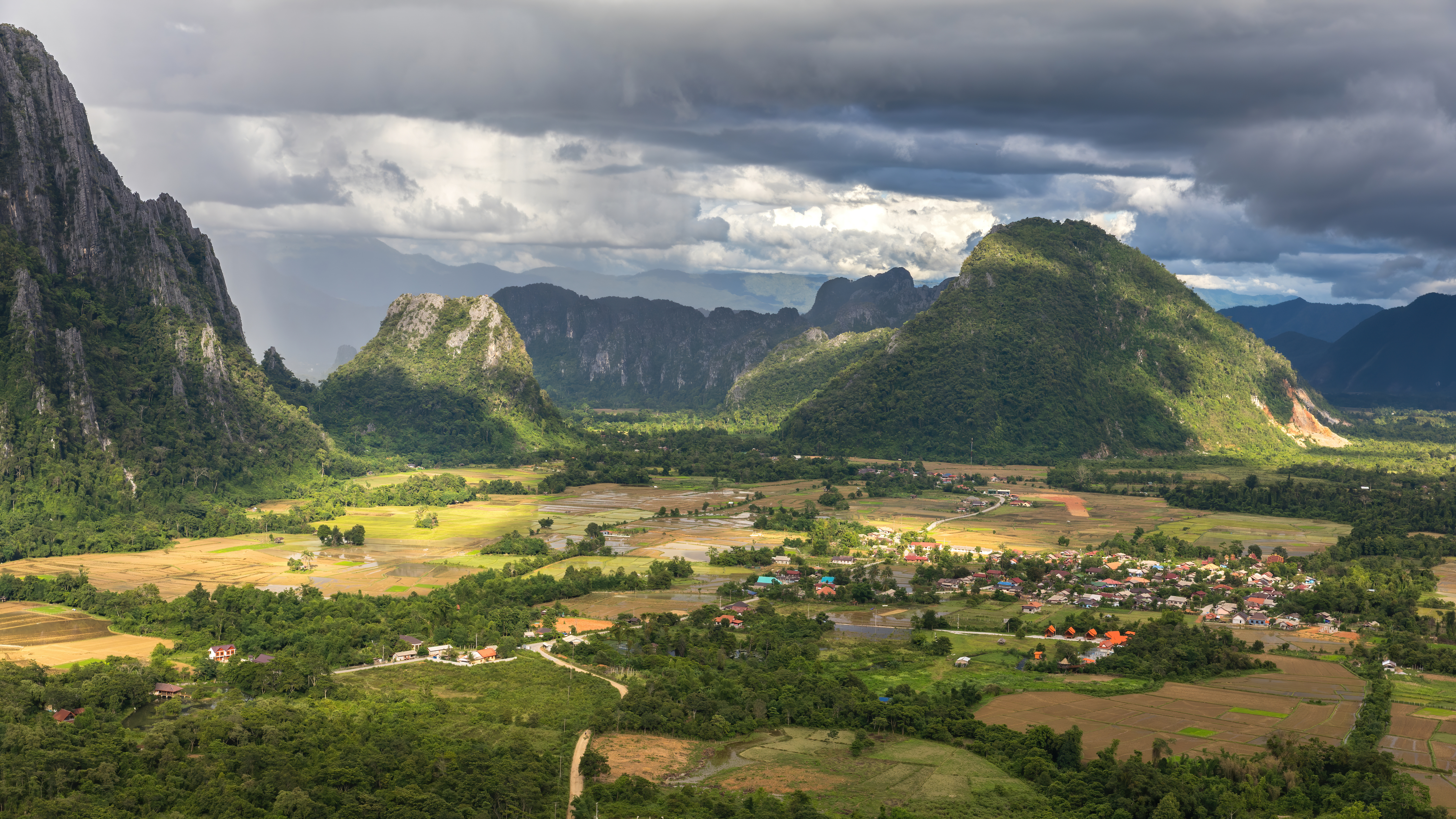
English: Karst peaks and green paddy fields under a stormy sky, South view from the top of Mount Nam Xay, during the monsoon, in Vang Vieng, Vientiane Province, Laos.
Français : Pitons karstiques et rizières vertes sous un ciel orageux, vue sud depuis le sommet du Mont Nam Xay, durant la mousson, à Vang Vieng, Province de Vientiane, Laos. |
| Dabisili kalinli | |
| Nyabli | Amaŋmaŋ tuma |
| Sab'sabira | Basile Morin |
| Other versions |
 |
| Camera location | | View this and other nearby images on: OpenStreetMap |
|---|
Assessment
This image was selected as picture of the day on Vietnamese Wikipedia for 26 March 2023.
|
|
Fukumisi shahira niŋbu
I, the copyright holder of this work, hereby publish it under the following license:
This file is licensed under the Creative Commons Attribution-Share Alike 4.0 International license.
- A mali sɔli:
- N pirigi – Diyi lee ka a yan labi ŋma, n tari ka yan zaŋ tuma n talim
- Lab laɣim – n taɣi dee tuma maa
- N-yɛn zaŋ dɔli zalikpana ŋɔ sɔli:
- ŋmahindibu – Di tu ni a ti nin'tiɣili din tu, ka yooi sɔli din yihiri shiɛhira gbaŋ, ka lahi wuhi di yi niŋ ka taɣibu daa pun niŋ. A ni tooi niŋ lala ŋɔ n-doli hankali ni saɣi shɛm, amaa ka di pa sɔ'shɛli din mali biɛhiŋ zaŋ kpa ŋun tiri shiɛhira gbana ŋɔ polo nin'tiɣili ni nyini bee a zaŋ tum.
- Tarimi li din nyɛ shɛm – A yi mali labi sabi bee a taɣi li mi bee a miɛmi n-tam sabiri kurili maa zuɣu, di tu ni a tari a tɔhibu maa doli same or compatible license n-zali maŋ-maŋ maa.
Faal tarihi
Dihimi dabisili/saha n-nya kɔl' bihi kamani di ni di yina shɛm
| Zuŋɔ dabisili/Saha | Thumbnail | Di tarisi | ŋun su | tɔhibu | |
|---|---|---|---|---|---|
| din na chana | 00:47, 26 Silimin gɔli July 2020 | | 6,494 × 3,653 (10.1 MB) | Basile Morin | Uploaded own work with UploadWizard |
Lahibali kɔligu zaŋ tum tuma
Din doli ŋɔ na yaɣili tuma nima zaŋ ti lahabali kɔligu ŋɔ:
Duniya zaa lahabali kɔligu zaŋ tum tuma
Wikis shɛŋa ŋan dolina ŋɔ gba malila faal ŋɔ n kuri bukaata:
- Zaŋ tum tuma arz.wikipedia.org zuɣuc
- Zaŋ tum tuma ast.wikipedia.org zuɣuc
- Zaŋ tum tuma ca.wikipedia.org zuɣuc
- Zaŋ tum tuma cy.wikipedia.org zuɣuc
- Zaŋ tum tuma de.wikivoyage.org zuɣuc
- Zaŋ tum tuma diq.wikipedia.org zuɣuc
- Zaŋ tum tuma en.wikipedia.org zuɣuc
- Zaŋ tum tuma fa.wikipedia.org zuɣuc
- Zaŋ tum tuma fr.wikinews.org zuɣuc
- Zaŋ tum tuma fr.wikivoyage.org zuɣuc
- Zaŋ tum tuma ga.wikipedia.org zuɣuc
- Zaŋ tum tuma gl.wikipedia.org zuɣuc
- Zaŋ tum tuma ha.wikipedia.org zuɣuc
- Zaŋ tum tuma ia.wikipedia.org zuɣuc
- Zaŋ tum tuma ku.wikipedia.org zuɣuc
- Zaŋ tum tuma oc.wikipedia.org zuɣuc
- Zaŋ tum tuma ru.wikinews.org zuɣuc
- Zaŋ tum tuma uk.wikipedia.org zuɣuc
- Zaŋ tum tuma vec.wikipedia.org zuɣuc
- Zaŋ tum tuma vi.wikipedia.org zuɣuc
- Zaŋ tum tuma www.wikidata.org zuɣuc