Lahabali kɔligu:Downtown Little Rock.jpg
Jɔhiyuli maa galisim:800 × 533 anfooni bihi bihi. Din pahi resolutions: 320 × 213 anfooni bihi bihi | 640 × 427 anfooni bihi bihi | 1,024 × 682 anfooni bihi bihi | 1,280 × 853 anfooni bihi bihi.
Faal maa maŋmaŋa (1,280 × 853 pixels, file size: 306 KB, MIME type: image/jpeg)
Lahabali jia
| Buɣisibu |
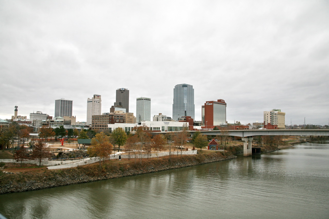
In 1673, the first European explorers to travel through the Arkansas River wilderness encountered the friendly Quapaw Indians. Nine years later the famed La Salle Expedition landed at "La Petite Roche," the little rock that rested along the wild banks of the Arkansas. Both French and Spanish expeditions followed, but even as late as 1819, when the Arkansas territory was created, the Little Rock area was still little more than a wilderness. The graceful bluffs of "La Petite Roche," did not go unnoticed for long. Little Rock became the seat of the new territorial government in 1821 and in 1831 was incorporated as a city. In 1836, Little Rock became the capital of the state of Arkansas. |
| Dabisili kalinli | |
| Nyabli |
|
| Sab'sabira | Cliff from I now live in Arlington, VA (Outside Washington DC), USA |
| Camera location | | View this and other nearby images on: OpenStreetMap |
|---|
Fukumisi shahira niŋbu
This file is licensed under the Creative Commons Attribution 2.0 Generic license.
- A mali sɔli:
- N pirigi – Diyi lee ka a yan labi ŋma, n tari ka yan zaŋ tuma n talim
- Lab laɣim – n taɣi dee tuma maa
- N-yɛn zaŋ dɔli zalikpana ŋɔ sɔli:
- ŋmahindibu – Di tu ni a ti nin'tiɣili din tu, ka yooi sɔli din yihiri shiɛhira gbaŋ, ka lahi wuhi di yi niŋ ka taɣibu daa pun niŋ. A ni tooi niŋ lala ŋɔ n-doli hankali ni saɣi shɛm, amaa ka di pa sɔ'shɛli din mali biɛhiŋ zaŋ kpa ŋun tiri shiɛhira gbana ŋɔ polo nin'tiɣili ni nyini bee a zaŋ tum.
| This image, originally posted to Flickr, was reviewed on December 13, 2009 by the administrator or reviewer File Upload Bot (Magnus Manske), who confirmed that it was available on Flickr under the stated license on that date. |

|
This image has been assessed under the valued image criteria and is considered the most valued image on Commons within the scope: Skyline of Little Rock. You can see its nomination here. |
Faal tarihi
Dihimi dabisili/saha n-nya kɔl' bihi kamani di ni di yina shɛm
| Zuŋɔ dabisili/Saha | Thumbnail | Di tarisi | ŋun su | tɔhibu | |
|---|---|---|---|---|---|
| din na chana | 21:47, 13 Silimin gɔli December 2009 | | 1,280 × 853 (306 KB) | File Upload Bot (Magnus Manske) | {{Information |Description=In 1673, the first European explorers to travel through the Arkansas River wilderness encountered the friendly Quapaw Indians. Nine years later the famed La Salle Expedition landed at "La Petite Roche," the little rock |
Lahibali kɔligu zaŋ tum tuma
Yaɣi shɛli kani din mali lahabali kɔligu ŋɔ n-kuri bukaata.
Duniya zaa lahabali kɔligu zaŋ tum tuma
Wikis shɛŋa ŋan dolina ŋɔ gba malila faal ŋɔ n kuri bukaata:
- Zaŋ tum tuma ang.wikipedia.org zuɣuc
- Zaŋ tum tuma bn.wikipedia.org zuɣuc
- Zaŋ tum tuma en.wikipedia.org zuɣuc
- Zaŋ tum tuma fr.wikipedia.org zuɣuc
- Zaŋ tum tuma incubator.wikimedia.org zuɣuc
- Zaŋ tum tuma sl.wikipedia.org zuɣuc