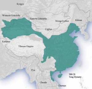
Tang dynasty
This template is part of the ArticlePlaceholder extension. If you want to adjust it, please consider making your changes upstream.
imperial dynasty of China from 618 to 907
pahi la
Di pilli ni
Zuliya wuhibu
ŋun pili
dunia yaɣili
tinzuɣu
naabu saha: 904
Pilibu saha: 618
indigenous to
located in the present-day administrative territorial entity
din nyɛ gɔmnanti nyolini
tingbani liɣiri
Din doli na
ŋun niŋ taɣibu n-nyɛ
saha sheli: 907
saha sheli: 907
valid in place: Jiangxi, Anhui
saha sheli: 690
Taɣi
saha sheli: 618
saha sheli: 884
saha sheli: 705
saha sheli: 668
saha sheli: 640
Pilibu saha
naabu saha
wuhigi,kpihimbu, dabisili
Bɔbili
saha sheli: 715
anfooni din wuhiri luɣushɛli mapu puuni


pɔhim zuɣu yuzaana: Outline map of the Tang empire in 661, when it reached its greatest extent. Map legend: dark-red: civil administration. red: military administration (Anxi protectorate): 649–670 and 675–755. light-red: briefly-controlled areas: Kunling, Mengchi, Sogdiana and Tokharistan protectorates (established 657–661, overthrown 665), Ungjin Commandery (660–671)
depicted by
pahi la: Twenty-Four Histories
pahi la: Twenty-Four Histories
Malibu Shɛi Bɔɣisibu
yatɔɣa ni jandi sheli: Q24485431
yatɔɣa ni jandi sheli: The New International Encyclopædia/T’ang
Piɛbu shɛŋa wikimedia nini ni miri cho
saha sheli: 31 Silimin gɔli October 2022
permanent duplicated item
Commons anfooni dundɔŋ ni
pubu Commons ni
yɛlikpani maŋmaŋa tɛmplaati
bachikpani yaɣa kpeeni
Reference
- ↑ 3 Silimin gɔli April 2019, https://github.com/JohnMarkOckerbloom/ftl/blob/master/data/wikimap
- ↑ Quora
- ↑ https://openlibrary.org/subjects/time:tang_dynasty_618-907, Tang dynasty, 618-907 | Open Library, 14 Silimin gɔli September 2023
- ↑ Freebase Data Dumps, 28 Silimin gɔli October 2013
- ↑ BBC Things
- ↑ GF WordNet
- ↑ National Library of Israel
- ↑ 8.0 8.1 8.2 Art & Architecture Thesaurus, 300018420, Silimin gɔli September 2020
- ↑ 9.0 9.1 sh85024059
- ↑ Q62687292

